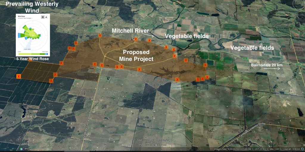
Vegetable fields and Mitchell River showing close proximity to proposed mining area
Video of the location of the vegetable fields, the Mitchell River, and the plateau beyond the river where the proposed Kalbar mine will be located.
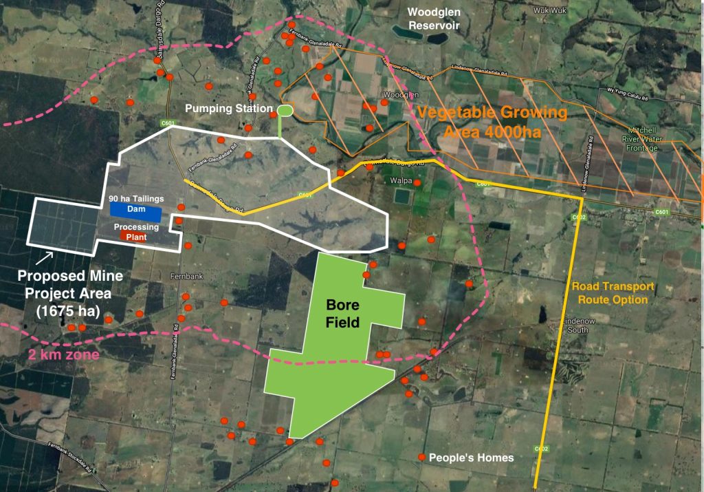
Overlay of mine (orange shaded area) showing proximity to the Lindenow Valley vegetable growing fields
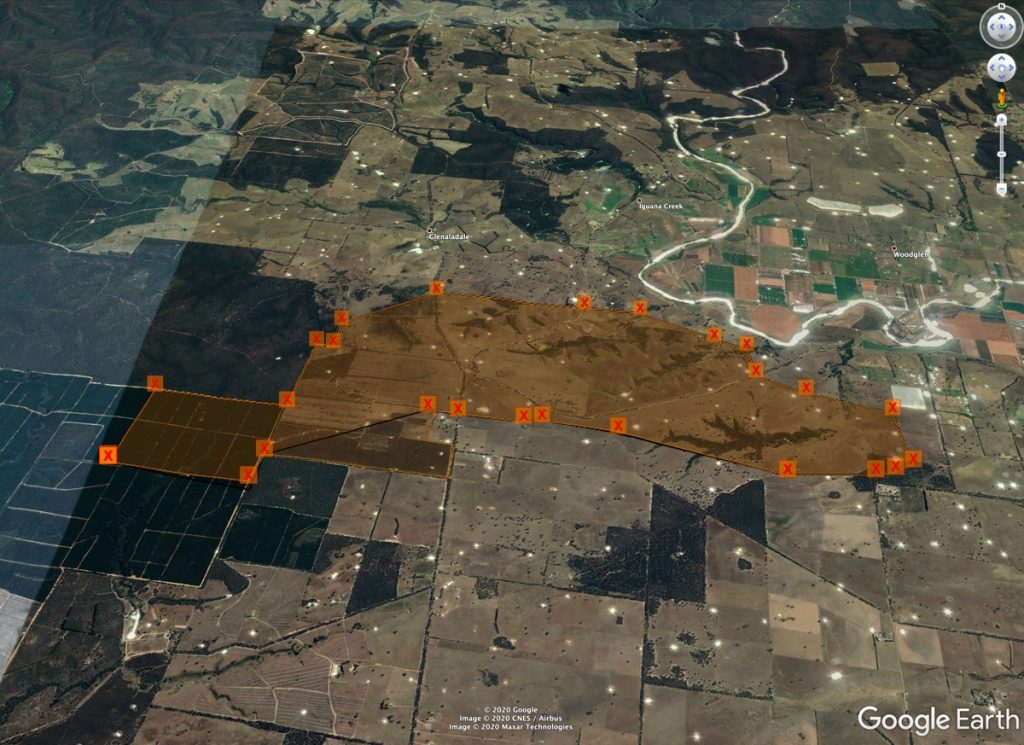
Wider area Google Earth view
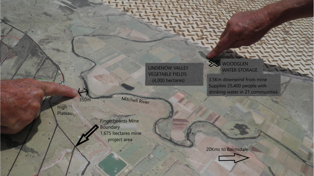
Proximity of boundary of mine (red line) to the Mitchell River. Blue line is the Bairnsdale-Dargo Road
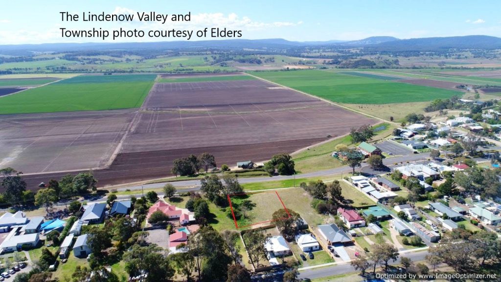
Lindenow township and the Lindenow Valley, the edge of the township is 4 km from the proposed mine boundary
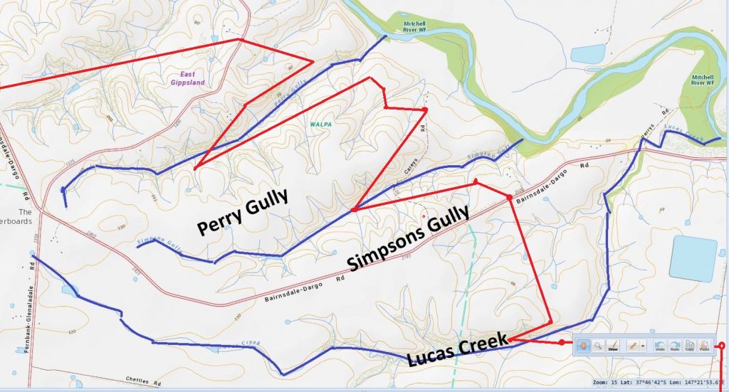
Shows the 3 major gullies situated on top of the plateau that eventually flow into the Mitchell River. The red line shows how close the mine pit will be to these gullies. There is a major risk of contamination of the River through sediment runoff.
Water to be captured and dams constructed stopping environmental flows into the Mitchell River, aquifers and onto adjoining properties
A “hands on” map showing key locations.
Shaded area shows 4000 hectares exempted from mineral exploration and licensing on the high quality soils of the Lindenow Valley floodplain as announced by the Minister for Resources on 22nd July 2019
This version only shows the 49 homes that Kalbar had identified. Since this map was marked up MFG has identified a total of 81 homes and a school within 2 km of the boundary of the mine licence.
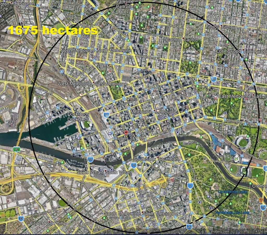
Overlay of proposed Kalbar mine total site area on top of Melbourne Central
Overlay of proposed Kalbar mine total site area on top of Bairnsdale
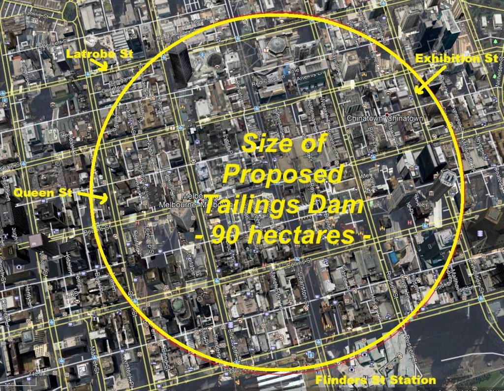
Size of proposed tailings dam, overlaid on Melbourne Central